


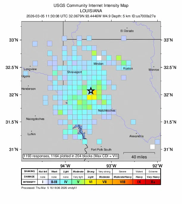
According to the United States Geological Survey (USGS), a magnitude 4.9 earthquake occurred at approximately 5:30 a.m. on March 5 just north of Edgefield, Louisiana, near U.S. Highway 71. The quake originated at a relatively shallow depth of about three miles below the surface, which likely contributed to residents across the area feeling the shaking.
The event now ranks as the second-largest earthquake recorded in Louisiana history. The only stronger quake documented in the state occurred on February 9, 2006, when a magnitude 5.3 earthquake struck near Grand Isle, Louisiana.
While earthquakes are relatively uncommon in Louisiana compared to other parts of the United States, they do occur occasionally as a result of geological stress along fault systems beneath the region.
Officials are encouraging anyone who felt the earthquake to help researchers by reporting their experience to the USGS. These public reports help scientists better understand how far the quake was felt.
Residents who experienced the shaking can submit a report online through the USGS “Did You Feel It?” system at:
https://earthquake.usgs.gov/earthquakes/eventpage/us7000s27e/tellus


Comments